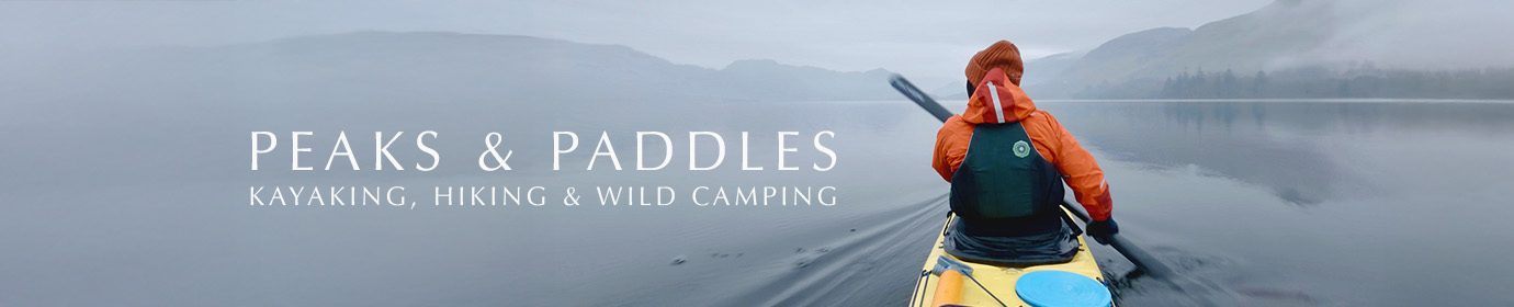
Scotland: The Affric Kintail Way
June 2025
Admittedly, I only found out about this long distance trail about two weeks before I did it. Having purchased a book on long distance walks in Scotland, this one caught my eye due to its relatively short length of 45 miles; as I had just wrapped up a big project at work, I was looking for something to do for a few days that wouldn’t necessarily require too many days off work as I had another longish kayaking break booked off for the following month.
After reading about the walk and watching a few videos about it, I was absolutely set on it. So many things appealed: it’s easily accessible via public transport, saving me a very long drive from Hertfordshire, it wasn’t over technical terrain, and despite its accessibility, much of the trail is surprisingly remote. I booked train tickets from London, stocked up on a few things and set off.
The train ride up on the Caledonian Sleeper threw a bit of a spanner in the works. A young man who boarded at Crewe caused such a disturbance on the carriage I was on that he was eventually removed by police at Perth. Suffice to say, no sleep was had and I arrived in Inverness in no shape to start walking as I’d planned.
I made the decision to catch the CityLink 917 bus down to Drumnadrochit, the starting point of the walk, but then instead of walking from there, I took another bus over to Cannich, where most walkers on the route spend their first night. I wasn’t overly devastated about missing this first leg as many walkers describe it as rather monotonous anyway (and indeed many walkers skip it because of this). I’m sure it’s nice enough but the route from Cannich to River Affric has much the same terrain, primarily along forestry tracks, so it’s not like I was going to completely miss out, as these first two stages are so similar.

After a restful stay at the wonderful Cannich Woodland Camping & Caravan Park, I rose bright and early, packed all my gear into my recently purchased (and now much loved) Atom Packs Prospector ultralight rucksack, and walked up the short country lane into town.
A small Spar shop in Cannich provides the last opportunity to stock up on consumables, and after grabbing a bag of vegetarian Haribo to stash in my pack (easily accessible in the Prospector’s famous “bottom pocket”, a stretchy pocket at the base of the pack), I made my way to the start of the Way’s stage two route, an initial gentle ascent up the hill behind town before the path leaves the road and heads into the trees. As mentioned, this stage of the route largely follows forestry track, initially through plantations before transitioning into proper wild Caledonian forest.
The weather was warm and humid, and the soft scent of wild flowers and pine mixed with the gentle hum of bees filled the air, the elevation making for lovely views out across the glen.
After a while the path leaves the open track and heads downhill through leafy woods, a short stroll through this shady canopy bringing you to Dog Falls, where I filled my filter bottle (the entire Way has plenty of water filling opportunities, a real boon as you don’t need to carry significant amounts of it at any point; just be sure to bring a proper filter for this) and had a small snack break, enjoying the leafy shade and sound of the river tumbling below the footbridge. As a kayaker I couldn’t help sizing up the rapids and thinking what fun they’d be to paddle.
There’s a car park here as well as an exceptionally clean and well-maintained toilet, so there were a few folks around picnicking and exploring the area around the river.

Continuing on the trail I soon found myself alone on the path. From this point, I wouldn’t see many other people; in fact, the total number of fellow hikers I encountered along the entire route of the actual Affric Kintail Way was only five. The forestry track meanders gently up and down small hills for many miles, sometimes closed in by the wood, at other times allowing a glimpse of the lochs and hills alongside. At one point, a small diversion takes you up to the Am Meallan viewpoint, providing a spectacular view westwards across Loch Beinn A’ Mheadhoin (pronounced “ben ah vay un”) and further down the trail, a tantalising hint of the scenery for the days ahead.
From a point shortly after this, there’s no more cellphone signal until the very end of the trail; I’d known this so had come prepared with my Garmin Messenger, just in case of any issues but also just to keep in touch with my partner back home. I would strongly advise others to bring a form of satellite communication on this route too.
It was early evening by the time I reached the River Affric Car Park, my intended stopover for the night. Stopping to set up cameras and launch my drone along the way takes up a surprising amount of time and energy, and I was absolutely exhausted by the time I reached the empty car park.
Finding a spot in the nearby woods, I pitched my tent and settled in for the night. The wind was quite gusty initially but eventually completely dropped, resulting in hordes of midges arriving and besieging me in my tent.

With similar conditions the following morning, I had to make a quick escape, packing everything as fast as I could while the damn blighters swarmed around me. Thankfully I’d brought plenty of Smidge and my head net, but they’re still infuriating. Heading back down to the trail I continued through the increasingly wild-feeling forests of Glen Affric.
This part of the trail is when the terrain starts to shift noticeably; you’re still walking on a relatively broad forest track for a while, but the glen steepens, and starts to open up and eventually the trail changes to a narrower, stonier one as you reach the end of Loch Affric, cross the River Affric once more and turn westwards, deeper into Glen Affric.
Passing a building labelled on the map as Athnamulloch, apparently a shelter for a local tree planting charity, and the private mountaineering club bothy Strawberry Cottage, I got the distinct feeling now of entirely leaving civilisation behind, at least for the time being. I stopped briefly at Strawberry Cottage, grateful for an outside bench to rest for a while and make a cup of coffee. Very light drizzle came and went throughout the early afternoon, a refreshing respite from the close air.
The scenery here was fantastic. I always love being in the mountains and I was really starting to get that feeling at this point. The undulating path offered views of the meandering river and occasional lochans, whilst mountains towered around the sides of the glen and the path crosses a few waterfalls and streams as it starts to turn slightly southwest along the foothills.
I came across three Scottish hikers walking in the opposite direction, and we stopped and chatted for a while about the trail and area, waxing lyrical about the beauty and remoteness.
After several hours of walking and filming, I reached Alltbeithe and the Glen Affric Youth Hostel, apparently the most remote YHA hostel in the Highlands. Reachable only by foot/bicycle (and possibly horse? There was certainly equestrian “evidence” along this section of the trail), this very basic hostel is often used by fellow walkers on the Affric Kintail Way. I’d originally planned to camp somewhat nearby the hostel and pay a fee to use their facilities, but a sign on the door announced that the entire hostel was closed for the day due to a private booking. Shit. As I was pretty exhausted by this point, this was something of a setback.
Nevertheless, I took the opportunity to have a bit of a break, airing my increasingly-blistered feet (I’d chosen to wear a pair of boots I’ve not worn for a long hike before, and paid the price) and dehydrating a meal while I figured out what to do next.

The best option was to push forward for another mile or so to Camban Bothy. Having never actually stayed in a bothy before, I was somewhat apprehensive about this option but was relieved, upon arrival, to find the place deserted.
By now it was around 7pm (did I mention that filming a walk like this takes up ridiculous amounts of time?), and I wearily set up my sleeping gear and hung wet items (I’d accidentally misjudged the depth of a puddle on the track between the hostel and the bothy, and both of my shoes had been completely filled with water) on the bothy’s numerous washing lines. Having read about mice eating through people’s backpacks to get to food here, I also hung up my food in a sealed bag on one of the lines too.
The bothy itself was visually glorious. It was like being in a Flemish painting, with the gentle light spilling in from outside onto its stony interior and sparse wooden furniture. As the sky began to dim and soft rain fell outside, I tucked myself in, thankful for the shelter from the weather and midges, who’d begun to gather en masse again as, once again, the breeze I’d enjoyed all day totally dropped.

Rising shortly before complete dark for a wee, I sleepily noticed some odd brown shapes outside as I walked past the window. As my brain fully awakened, and I realised that a herd of around 30-40 red deer had surrounded the bothy, I slowly snuck back into the shadows of the bothy interior, picked up my camera and started filming them.
A stag was right outside the door, and although he noticed me, I was able to film him before he spooked and moved slightly downhill. Incredibly, I was able to stand outside filming the herd for some time; this encounter was an absolute highlight of the trip for me. Although finding two ticks on my one leg a short while later was a slightly unpleasant price to pay for it.
Leaving the bothy the following morning, I knew I had an incredible day ahead. The path now heads into the Kintail mountains and becomes increasingly rugged before steeply descending a few kilometres before the end of the trail, and I knew from Youtube videos that I’d be passing a spectacular waterfall on the Allt Grannda river. I’d specifically reserved the last remaining charged drone battery for this leg as I knew I wanted to get some aerial footage of the mountain track and waterfall.

I heard the waterfall before reaching it. Tumbling from a significant height, it’s really quite the crowning glory of this final stage. This is the only section of the trail where it gets a little, let’s say, sketchy, as the path narrows quite considerably in the vicinity of the waterfall and for a short while beyond, often with a very significant drop to the side. Hikers who don’t deal well with heights may find this part difficult, but there are only a few short bits that are like this. Just focus on putting one foot in front of the other and you’ll be fine.
Beyond the waterfall, the path continues to descend quite steeply, dropping into the expanse of the stunning Gleann Lichd, the remaining 6km of the path now directly ahead, a broad track winding alongside the River Croe as it heads to Loch Duich and the sea beyond. Another private bothy, Glenlicht House, sits near a footbridge where the path crosses the river and heads towards Morvich, and the end of the Affric Kintail Way.

At this point, a mixture of relief and sadness washed over me. Relief that I’d soon be able to shower and rest, and sadness that this incredible experience was coming to an end. For a relatively short long distance route, the Affric Kintail Way is an astonishingly beautiful one, with such a variety of scenery. The sense of isolation and remoteness it offers is remarkable, and even though I’d faced some setbacks, blisters, the ticks, the midges and flooded shoes (thankfully I’d brought along a pair of waterproof socks which then kept my feet dry in my wet shoes for this last day), I can honestly say it was one of the best experiences I’ve ever had.
The weather had been turning for the past hour or so, and low cloud was pouring into the glen, along with rain. It was an incredibly atmospheric way to end the trail.
I’d hoped to get one big sweeping shot of Morvich with my drone as I arrived, but alas, the last battery had depleted to the point that the drone wouldn’t even take off. Noticing my phone had acquired a few bars of signal, I excitedly called my partner to let him know I’d reached the end. Feeling exhausted but elated, I trudged the last kilometre into town and finished my walk.
I stayed at the nearby Morvich Club Campsite for the night (which had really nice facilities including a drying room), before walking around 2km to the A87 the following morning and catching the 917 bus back to Inverness from the roadside near the Pitstop restaurant; this stop wasn’t listed on CityLink’s website when I checked, but you can simply stand on the roadside and hail the bus as it passes. You can clearly see it coming across the causeway further up the road so you can’t miss it as it approaches.
A few days later I edited together the film linked above. Having chosen my usual style of silent hiking for the film, I’d focused on the wonderful scenery while also reluctantly, as always, appearing in front of the camera to provide a visual narrative anchor to viewers. The film is intended as a meditative and calming experience, a homage to the forest, glens and mountains of the trail, and hopefully serve as an inspiration for others to walk this route themselves.
Details
Distance
The Affric Kintail Way is widely listed as being around 45 miles/72km; in reality I found the stages slightly longer by my Apple Watch’s measurement, by a kilometre or so here and there. If you’re accessing it via public transport, you’ll walk an additional 2km or so from Morvich to the A87.
Difficulty
I’d say you need at least some hillwalking experience and reasonable fitness to do the trail, as even though it’s short by “long distance route” standards, it’s still a fair few miles. The path undulates up and down but it’s generally gentle; there’s no significant ascent if you’re doing the trail from east to west, as most do; hikers walking from west to east will have an initial steep ascent into the mountains.
The entire route is well marked and obvious; there are never any sections where the path disappears. Some parts, especially between Alltbeithe and Camban, are a little boggy, and the track between Athnamulloch and Morvich is generally a bit rough, so comfortable, preferably waterproof footwear is essential.
There are several fords; if there’s been significant rain in the preceding days, these may require a diversion off the track to find a safer crossing.
The descent through the Kintail Mountains is rocky in places but not technical; a few sections of narrow track, especially around the Allt Grannda waterfall, where the drop alongside is very steep, may bother hikers who don’t have a head for heights, but these sections are short.
Access
This route is entirely doable by public transport. I came via Inverness; at least two regular CityLink/Stagecoach bus routes from the bus station link Inverness to Drumnadrochit (fare around £14), whilst the CityLink 917 (fare was about £30) brings you back to Drumnadrochit or Inverness (or, alternatively, northwest to Skye) from near Morvich at the end, with four services a day in each direction.
If, like me, you choose to skip the first stage, StageCoach Bus 17 runs between Drumnadrochit and Tomich several times a day, stopping in Cannich; you can catch it from the small bus shelter opposite the point where the bus from Inverness drops you off.
Be sure to check the timetables; I was unable to find the A87 bus stop on the CityLink website but you can figure out the rough time by checking the arrival/departures from nearby Shiel Bridge). The Pitstop restaurant next to the spot where you hail the bus provides a handy shelter for passing time and grabbing some food and drink. It was open from 10am when I was there.
Practicalities
After Cannich, there are no shops or resupply points until Morvich; the campsite here has a small shop stocking basic food items and a few camping items like gas canisters. There is a small convenience store behind the Pitstop restaurant on the A87 outside Morvich.
Water is abundantly available by filtering from rivers and streams.
There are toilets at Dog Falls, the River Affric Car Park, the YHA Hostel at Alltbeithe, and a composting toilet at Camban Bothy.
There is no phone signal at all between Loch Beinn A’ Mheadhoin and Morvich; as this is a fairly significant distance, a satellite communication device is useful. I found my Garmin Messenger useful not only for keeping in touch with my partner, but also for getting updated weather forecasts once or twice a day.
There is no public road access between the River Affric Car Park and Morvich.
Outside of winter, insect repellant (eg Smidge) and protection like a head net, is essential. Be sure to check your body every day for ticks, and carry a pair of tweezers for removing them. Avoiding walking through long grass and wearing trousers instead of shorts will largely help to prevent the acquisition of these unwanted passengers, but it’s essential to check, as removing them as quickly as possible is important to avoid the transmission of infections like Lyme disease. Historically, both midges and ticks have usually only been an issue in summer in Scotland, but for the past few years I have been encountering them as early as April and as late as the end of October.
Between July and mid October, there may be deer stalking activity in parts of Glen Affric and the surrounding areas. This doesn’t prevent access but walkers should be aware; more information is available here.
Safety
Since this route isn’t technical, specialised equipment isn’t likely to be necessary for most walkers; although the Kintail mountain section may require crampons or at least mini spikes in particularly icy conditions. Having said that, I think the mountain section between Gleann Lichd and the waterfall would be best avoided in those conditions by walkers without prior experience of Scottish winter mountain conditions.
There are adders present in this area, although your likelihood of encountering them is very low. They’re very shy of humans and bites are very rare.
The lack of phone signal for more than half the route may be an issue for some. As mentioned above, a satellite device (eg Garmin or Zoleo) is beneficial. There is a Mountain Rescue hut in Morvich, but you’d need a method of communicating with them.
As with any mountainous area, the weather is likely to be changeable; forecasts can only tell you so much, and even if the forecast is looking favourable when you set out, you should still bring waterproofs and some form of insulating clothing.
Much of the route feels very remote and isolated; this is an attraction for some, and an issue for others. Consider this carefully when deciding whether or not this route is for you.
As a solo woman, I personally felt totally safe and confident for the entire route that I walked. The few hikers I encountered were all friendly; typically, my experience has always been that fellow outdoors people in the UK tend to be amiable and helpful. If, like me, you’re walking alone, let someone know your day-to-day plan and expected finishing day/time.


